Project experience

Selected past projects in freeway, construction, and traffic analysis.

A focused sample of owner-led work supporting MnDOT and corridor decision-making.

  • Synchro
  • SimTraffic
  • StreetLight
  • Travel Time Data
  • Detector Data
  • Queue Analysis

Projects that best show the firm's core strengths

These examples highlight construction impacts, staging strategy, freeway review, and data-informed recommendations for agency delivery.

TH 280 project map from construction traffic impact analysis

Construction impact analysis

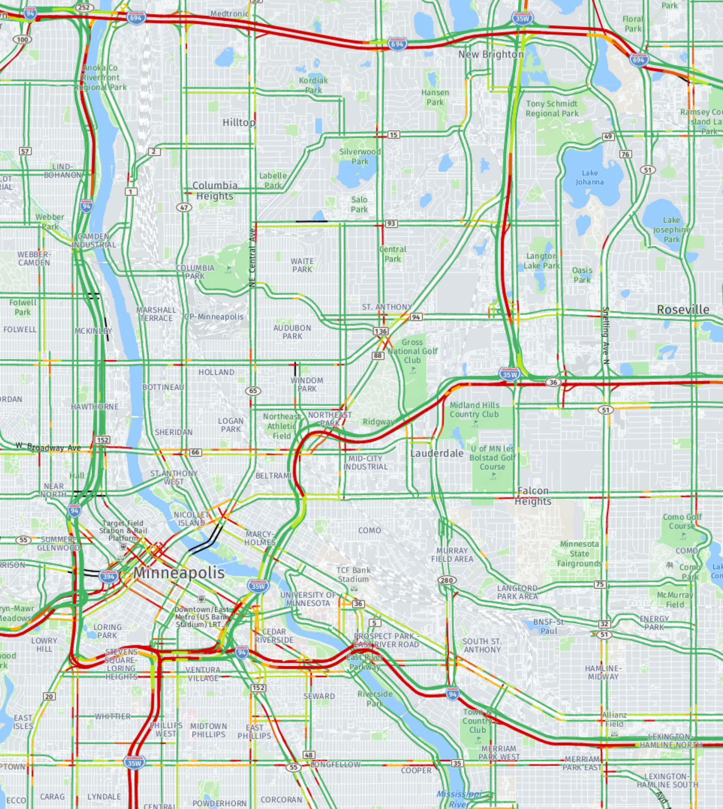
SP 6242-83 | TH 280 Construction Traffic Impact Analysis

Evaluated bridge, ramp, and neighborhood access around TH 280 and I-94 to support traffic management decisions during construction.

  • Challenge: maintain corridor and neighborhood access while multiple bridges and ramps were affected.
  • Approach: reviewed ramp demand, bridge traffic, and detour options to preserve key connections.
  • Value: supported traffic management decisions for a high-sensitivity metro freeway corridor.
  • Work Zone Analysis
  • Ramp Access
  • Metro District
Transportation modeling network graphic

Work zone modeling

SP 2750-85 | TH 169 from 101st Ave to Hayden Lake Rd

Used Synchro and SimTraffic to evaluate northbound lane closure impacts, delay, and queue risk during pavement rehabilitation.

  • Challenge: understand NB TH 169 lane closure effects through a signal-controlled section without direct freeway detector coverage.
  • Approach: built a Synchro and SimTraffic model to test afternoon peak delay and queue risk during rehabilitation work.
  • Value: helped define when impacts would be most severe and supported construction planning with modeled operations insight.
  • Synchro
  • SimTraffic
  • Lane Closure
TH 169 at 36th Avenue project map

Freeway diversion analysis

SP 2772-125 | TH 169 at 36th Ave

Tested diversion and queue effects on adjacent routes, including I-394 and I-494, under weekend closure conditions.

  • Challenge: estimate how weekend closure conditions on TH 169 would shift traffic to nearby freeway routes.
  • Approach: reviewed diversion scenarios and queue effects on I-394, I-494, and related connections.
  • Value: supported closure planning with clearer expectations for redirected traffic and delay risk.
  • Diversion Analysis
  • Queue Review
  • Weekend Operations
TH 12 staging alternatives project graphic

Staging strategy

SP 2713-129 | TH 12 Staging Alternatives

Compared staging options using travel time review to support a lower-impact construction strategy.

  • Staging Alternatives
  • Travel Times
  • Operational Review
TH 77 StreetLight ramp study map

StreetLight and ramp study

TH 77 MnDOT StreetLight Ramp Study

Combined MnDOT loop detector volumes with StreetLight origin-destination data to recommend which ramps could close concurrently.

  • Challenge: identify ramp closure combinations that would minimize corridor disruption during planned work.
  • Approach: paired MnDOT loop volumes with StreetLight origin-destination data to isolate the most critical ramp movements.
  • Value: turned raw travel-pattern data into clear ramp closure recommendations for project delivery.
  • StreetLight
  • Ramp Study
  • Origin-Destination

Travel patterns and corridor behavior

Regional Bottleneck and Reliability Study

Evaluated regional bottlenecks and corridor performance using measures such as Travel Time Index and Planning Time Index.

  • TTI
  • PTI
  • System Performance

Additional project work by category

TH 5 corridor image for construction impact and freeway work

Construction impact and work zones

  • SP 2781-544 | I-94 Dartmouth Bridge
  • SP 2772-115 | US 169 at Rockford Bridge
  • SP1906-71 | US 52 Construction Impact Analysis
  • SP1928-91 | TH 52 over I-494 Bridge Deck Replacement
  • SP 5880-1998 | I-35 Hinckley Construction Impact
  • SP 0208-165 | Construction Impact Analysis
TH 101 corridor map for staging and traffic management work

Staging, detours, and traffic management

  • TH12 Detour Analysis | SP 2713-123
  • S.P. 1921-107 | TH 3 at Rosemount Detour Study
  • I-35 NB Lane Closure @ Rush City
  • SP 7001-128 | TH 13 from 101 to Quentin Ave
  • SP 7001-128 | Head-to-head on WB lanes
Snelling corridor visualization for freeway and corridor studies

Freeway and corridor studies

  • SP2732-105 | TH 5 Impact Analysis Report
  • SP 2736-46 | TH 101 Analysis
  • SP 2724-130 | TH 55 at Lake St
  • SP 2723-146 | TH 55 Pedestrian Tunnel at Douglas Drive
  • SP 8201-21 | TH 97 updates
  • SP 6215-114 | Snelling Ave from St. Clair to Grand Ave
Modeling network image for forecasting and data support

Forecasting, data, and modeling support

  • Robert St Study 2046 No-Build Traffic Forecast
  • TH 77 MnDOT StreetLight Ramp Study
  • TH 77 Travel Pattern Updated
  • Traffic Study Hwy 169 Restripe
  • Regional model validation and related modeling support
Regional model and network image for MPO studies

MPO planning and system performance studies

  • HOV occupancy rate study
  • Regional bottleneck study using multiple datasets
  • Travel Time Index and Planning Time Index evaluation
  • Origin-destination study
  • TH 77 Travel Pattern Updated

Additional project details, methods, and project-specific roles can be provided upon request.